|
In 1672, Dollier de Casson, Father Superior of the Sulpicians, and Bénigne Basset, a notary and surveyor, drew up a plan for the streets of Montréal, incorporating those already laid out under de Maisonneuve. They planned a thoroughfare along a straight line, and dedicated it to "Our Lady," or "Notre-Dame."
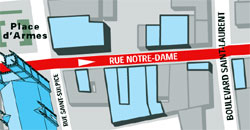
Here you are visiting the central section (to the west of boulevard Saint-Laurent) of this historical artery, which has never stopped changing down through the years. When the fortifications were still standing, prominent citizens took up residence on Notre-Dame, including explorer Daniel Greysolon, Sieur du Luth (who gave his name to Duluth, Minnesota) and, slightly farther east, the Sieur de Lamothe-Cadillac, founder of Detroit, Michigan, and the Sieur de la Vérendrye, who explored the West.
|

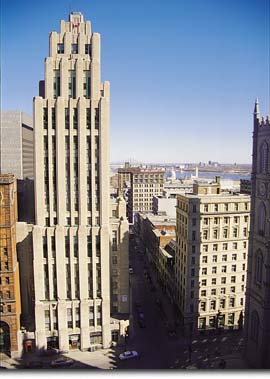
Office buildings, including the Duluth, on the right in this photo, and the Métropole building, farther east, opened on Rue Notre-Dame at the turn of the century. The Aldred building can be seen on the left (see section 16).
|
| Home | Site map | Contact us |
Credits. All rights reserved, 1998-2001.
|
