The banks
of the St. Lawrence
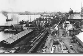
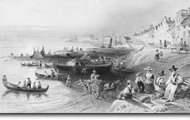
The banks of the St. Lawrence have changed considerably. Many years ago, instead of strolling along the esplanade running next to Rue de la Commune, you would have had your feet in the water, several metres lower.

The Port, circa 1885. Notman Studio.
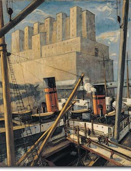
For many years, steamships would put in at the permanent docks, built starting in 1840 at the foot of Place Jacques-Cartier, and their passengers would get a glimpse of Montréal through the buildings lining the Port. Then, in the early 20th century, long piers and gigantic grain elevators were built, to store the grain shipped from western Canada for export. The grain elevators are still an important part of the skyline of the Port.
|

The banks of the St. Lawrence, as seen by W. H. Bartlett, in 1841. Firewood delivered
to Montréal was piled here.
 The Port, with grain elevators,
painted by Adrien Hébert in 1924..
†
Eastern end of the Old Port |

